Where is the Llogara Pass?
The Llogara Pass, Qafa e Llogarasë in Albanian, is the high point of the road from Vlorë to the southern Riviera, inside Llogara National Park. The park lies south-east of Orikum, 37 km from the city of Vlorë, and the national protected areas agency describes the way up as the Vlorë–Dukat–Llogara road, all the way to the pass.
It is a protected landscape, not just a viewpoint. A Council of Ministers decision, no. 59 of 26 January 2022, enlarged the park to 1,769.2 ha, and the Protected Areas Administration of Vlorë County manages it.
Pass or tunnel: which way to Dhërmi?
Take the tunnel if you are in a hurry and the pass if you want the mountain. The Llogara Tunnel is open to traffic: 6 km long, it cut the drive from Dukat to Palasë from about 30 min to about 7 min, according to the government's Media and Information Agency.
The tunnel runs under the mountain, so the park, its viewpoint and the old flag pine stay on the road over the top. The table sets the two side by side with the official figures we found.
| Way | What you get | Official figure |
|---|---|---|
| Llogara Tunnel | The quick crossing between Dukat and Palasë, with no views | 6 km; about 7 min instead of about 30 min |
| Over the Llogara Pass | The national park, its viewpoint and the Pisha Flamur | Park from 450 m to 2,018 m; the flag pine at 910 m, kilometre 31 of the Sarandë–Vlorë road |
What is there to see at the top?
The view is the reason to stop: the National Tourism Agency points to the spot where the mountain meets the sea, with the Ionian coast and the Riviera spread out below. It also lists hiking trails, picnics and paragliding over the slopes.
From Caesar's Pass, Qafa e Cezarit, the park authority describes a view over the Karaburun peninsula, the Dukat plain, the Orikum lagoon and the Ionian Sea. Where the road leaves the park, at kilometre 31 of the Sarandë–Vlorë road, stands the Pisha Flamur, the 'flag pine', at 910 m.
Llogara is also a forest of fir and black pine. The park authority counts about 1,400 vascular plant species and 105 bird species, with wolves, wild boar and roe deer among its mammals.
How far is Dhërmi from Sarandë and Vlorë?
Dhërmi is 72 km from Sarandë and 52 km from Vlorë, according to Albania's National Tourism Agency. It belongs to the municipality of Himarë and sits between the two cities on the Ionian coast.
That puts it well north of the nights on this site: in 2026, every one of them took place in Sarandë or Ksamil. If you sleep in Dhërmi, a club night in the south means 72 km of road home; Saranda or Ksamil helps you choose between the two party towns.
| From | To | Distance |
|---|---|---|
| Vlorë | Llogara National Park | 37 km |
| Vlorë | Dhërmi | 52 km |
| Sarandë | Dhërmi | 72 km |
What is Dhërmi like by day?
Dhërmi is two places: an old village on the mountainside and a beach below it. The tourism agency describes stone houses and narrow lanes on the slopes, with views over the Ionian, and names the churches of Saint Mary and Saint Stephen; the monastery of Saint Theodore stands on the hill.
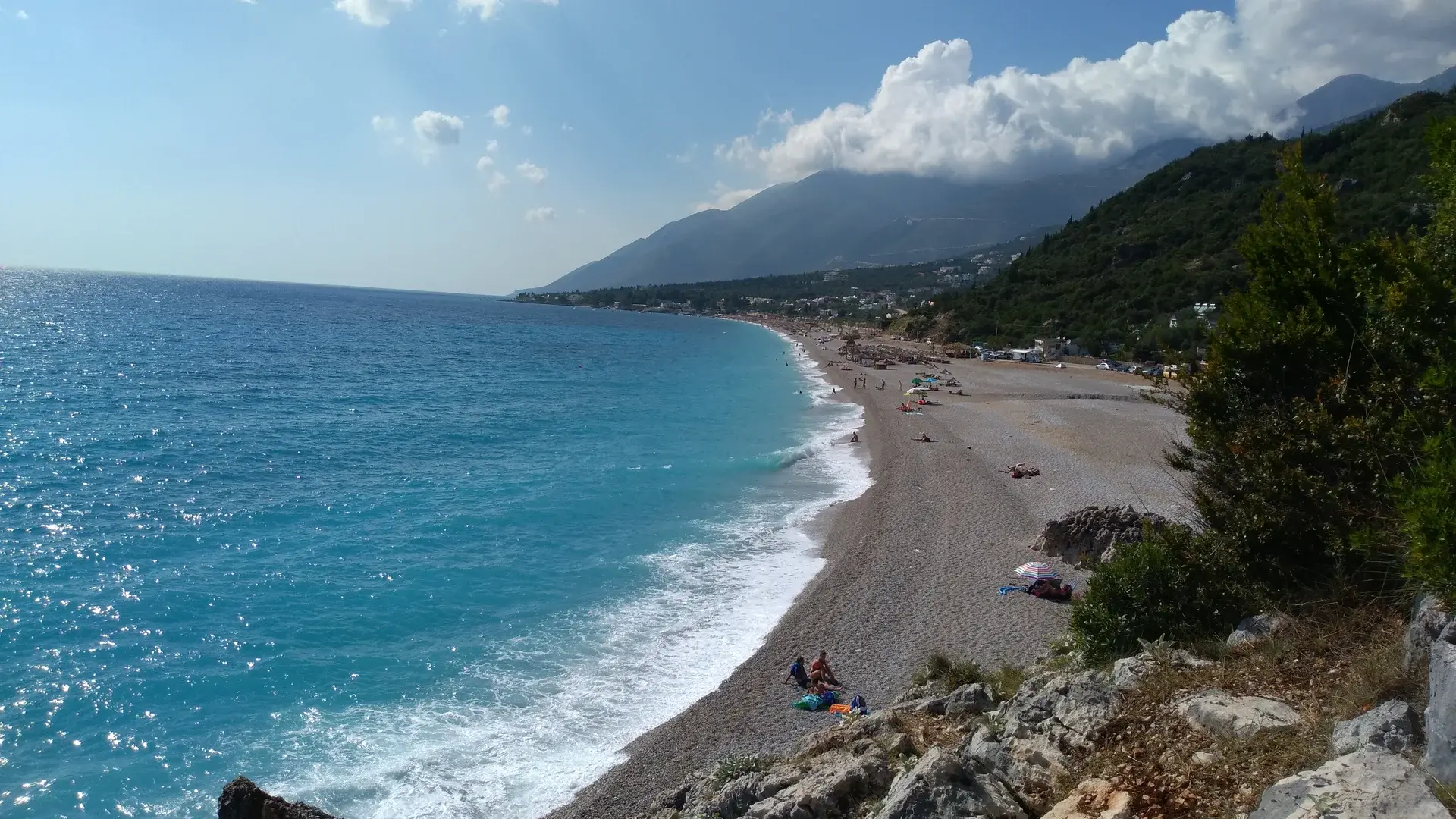
The village has three main quarters, Kondraqa, Gjileka and Dhërmi. Down on the shore, the main beach mixes stretches of rounded pebbles with patches of fine sand.
Around it, the agency lists the beaches of Alevrat, Gjipe and Gramë and the Pirates' Cave. Gjipe is a bay hidden between cliffs that you can only reach on foot or by small boat, which keeps it quieter.
Is there nightlife in Dhërmi?
Yes, in summer, and on a beach scale rather than a club one. The National Tourism Agency describes Dhërmi beach as a place of nightlife, with bars and restaurants by the water, without naming venues, so neither do we.
The big date comes in June. Kala Festival, held on the beaches of Dhërmi, has announced its 2027 edition for 2 June to 9 June 2027, on open-air stages by the sea.
The nights we list are further south, in Sarandë and Ksamil: Albania nightlife maps them, and the 2027 season shows what has been announced so far.